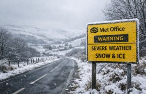
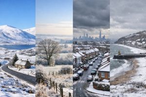
As 2025 draws to a close, the Met Office has issued widespread snow and ice warnings for New Year’s Day and beyond, marking the UK’s first real brush with winter this season.
A sharp Arctic blast is forecast to sweep across the country, bringing freezing temperatures, gale-force winds and significant snowfall in parts of northern Scotland.
Meanwhile, health officials have sounded alerts for much of England, warning of increased risks to vulnerable people as the cold settles in.
With conditions changing rapidly, this guide breaks down what to expect across the regions, how cold it will get, and how the UK Health Security Agency (UKHSA) is responding to the emerging threat.
Whether you’re staying home or heading out to ring in 2026, it’s time to prepare for an icy start to the new year.
Why Has the Met Office Issued Snow and Ice Warnings for the New Year?

The warnings stem from a significant change in the weather pattern. Arctic air is pushing south across the UK, leading to sharp temperature drops and unstable conditions. A strong northerly wind is expected to develop, causing widespread frost, snow showers and potential travel disruption.
Deputy Chief Forecaster Mark Sidaway explained that this cold spell will not be brief. Instead, conditions are expected to persist through the first week of January, with more snow and ice alerts likely.
The Met Office issued a yellow warning for snow and ice in northern Scotland from 6 AM on 1 January through midnight on 2 January. The forecast also includes frequent snow showers and strong winds, especially in northern areas.
Which UK Regions Are Likely to See the Heaviest Snow?
According to Met Office data and regional forecasts, northern Scotland is set to receive the most significant snowfall. Elevated areas above 200 metres could see between 10 to 30 centimetres of snow, with lower areas expecting 2 to 10 centimetres. The snow is likely to be accompanied by strong winds, creating blizzard-like conditions.
Other regions such as Northern Ireland, northern England and parts of Wales may see snow later in the week, though not at the same intensity.
Snow Risk by Region
| Region | Snow Forecast | Expected Accumulation |
| Northern Scotland | Heavy, prolonged snowfall | 10–30cm in higher areas |
| Northern England | Snow showers later in week | 2–5cm in some areas |
| Northern Ireland | Snow possible by weekend | Light to moderate |
| North Wales | Patchy snow expected | Light |
| Southern England | Minimal snow risk initially | Mostly frost |
How Cold Will It Get on New Year’s Eve and Day?
New Year’s Eve will start off frosty in many areas, with parts of the Lake District and southwest Scotland dropping to -4°C by morning. Across England and Wales, temperatures will hover close to freezing.
As the night progresses, southern England could become the coldest region for New Year celebrations. In contrast, parts of northern Scotland could briefly feel milder, reaching 6°C to 8°C during the day.
New Year’s Day brings a noticeable drop in temperature across the UK, particularly in northern areas where values may remain just above freezing, or even below.
What’s the Regional Forecast for the UK?

Each UK region is experiencing the cold spell differently. Here’s what to expect based on the latest Met Office data:
London & South East England
Dry and sunny with light winds on New Year’s Eve, dropping to around 5°C. Frost is expected overnight. New Year’s Day will stay mostly dry, but there is a slight chance of snow, particularly in coastal areas.
West & East Midlands
A frosty start with sunshine on New Year’s Eve. Temperatures will reach around 5°C. Showers are expected on New Year’s Day, with snow possible later, especially in elevated or coastal regions.
North West & North East England
Cold and dry to begin with, but becoming cloudier by evening. Showers will return on New Year’s Day, with a growing risk of snow, frost, and ice later in the week. Temperatures will stay between 3°C to 6°C.
Scotland
A mix of sunshine and cloud with snow moving in during the evening of New Year’s Eve. New Year’s Day will bring strong winds and heavy snow, particularly in northern areas. Temperatures may remain below freezing throughout the day.
Wales & Northern Ireland
Cold, frosty and bright conditions expected for New Year’s Eve. New Year’s Day will be cloudy with scattered showers and a possible shift to snow in higher regions by the evening.
Why Have Cold Health Alerts Been Issued Across England?
The UK Health Security Agency (UKHSA) has issued amber cold health alerts for the North West and North East of England, active until 12 PM on 5 January.
All other English regions are under yellow alerts. These warnings highlight the likelihood of health impacts caused by the cold, particularly among older adults, people with existing conditions, and vulnerable groups.
According to UKHSA, amber alerts signal probable increases in deaths, hospital admissions, and wider pressures on the healthcare system. Cold weather can also lower indoor temperatures in hospitals and care homes, which poses further risks.
Dr Agostinho Sousa, Head of Extreme Events at UKHSA, urged people to check on friends and neighbours, especially those living alone or with limited mobility.
Will This Cold Spell Cause Travel Disruptions?
Yes, travel disruption is a concern, particularly in areas under snow and ice warnings. The Met Office notes the potential for road closures, stranded vehicles, and public transport delays, especially in rural parts of northern Scotland.
Strong winds and heavy snowfall increase the risk of drifting snow and reduced visibility. Rail networks and smaller airports may also face disruption if conditions worsen.
Those travelling around the New Year are advised to monitor local travel updates and allow extra time for journeys.
Is This Cold Weather Expected to Continue Into Next Week?

Early forecasts indicate that this Arctic cold spell will extend into the first full week of January. While some milder air may push into southern regions at times, colder air will remain dominant in the north.
There is also growing speculation among forecasters about the potential for more widespread snow across England and Wales next week. While these developments are still uncertain, the Met Office is monitoring conditions closely and may issue new warnings in the coming days.
How Can People Stay Safe During This Weather Event?
Residents across the UK are advised to stay informed by regularly checking official forecasts. Cold weather can pose serious health risks, especially to vulnerable people.
Quick Tips for Staying Safe
- Keep your home heated to at least 18°C, especially overnight
- Wear multiple thin layers to retain warmth
- Avoid unnecessary travel during snow and ice warnings
- Check in on elderly neighbours and those with health conditions
Conclusion
With a powerful Arctic air mass sweeping in, the UK is set for a sharply cold start to 2026. Snow and ice warnings are now in place, especially for Scotland and northern regions, and health alerts have been issued across England due to the prolonged chill.
This guide has brought together the latest updates to help you prepare for a potentially disruptive start to the year. Whether you’re planning New Year celebrations or simply trying to stay warm, staying alert to official advice is more important than ever.
The first week of January may bring more snow, more warnings, and more challenges, but also the clear reminder that winter has officially arrived in Britain.
FAQs
Will the entire UK experience snow this week?
No, heavy snow is expected mainly in northern Scotland, but parts of Northern Ireland, northern England and Wales may also see snow later in the week.
What does the amber health alert mean for the public?
It indicates a significant risk to health and increased pressure on the NHS, especially affecting elderly and vulnerable individuals.
How much snow is expected in higher areas of Scotland?
Up to 30cm of snow could accumulate in elevated areas, with blizzard conditions possible.
Are there travel warnings in place?
Yes, especially for northern regions under snow and ice alerts. Drivers and travellers should prepare for delays and check conditions before leaving.
Will the cold weather continue into mid-January?
The Met Office expects the cold spell to last through at least the first full week of January, with the possibility of more snow.
What temperature is considered dangerous indoors during cold weather?
The UKHSA recommends heating homes to at least 18°C to avoid health risks, particularly for the elderly.
Could southern England see snow next week?
While not guaranteed, weather systems may bring snow to southern regions, depending on how the cold air interacts with incoming moisture.


